Over the last couple of decades, a theory that the accumulated snow cover in Siberia during October can impact Winter weather in the United States has gained popularity among everyone from weather forecasters and snow plow operators to insurance companies and hedge funds. Even the US National Oceanic and Atmospheric Administration monitors the snow cover in Siberia to craft its winter forecasts. It’s a different approach to traditional forecast methods that rely more heavily on El Niño-Southern Oscillation (ENSO) models and it has been right approximately 75% of the time since 1999.
Dr. Judah Cohen, a director at Atmospheric and Environmental Research (AER), is credited with discovering the connection between Siberia’s snow cover and weather here in the US. Known as the “Siberian Snow Theory”, Cohen says that Siberia’s snow doesn’t typically affect the West because the cold air it helps funnel down from the Arctic tends to get blocked by the region’s mountains. However, when snow cover in Siberia is heavier than usual, it favors the negative phase of the Arctic Oscillation (AO) over the northern hemisphere during winter.
The Arctic Oscillation is one of Earth’s most important atmospheric climate cycles. It occurs over the Arctic and influences mid-latitude weather patterns over the entire globe. On average, there is low pressure centered over the North Pole. This tropospheric vortex tends to be stronger in winter than it is in summer, and thus the influence of the Arctic Oscillation is greater in winter than it is in summer. The strongest wind speeds of this circulation are known as the polar jet stream, aka the polar vortex.
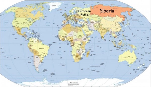
When the Arctic Oscillation is negative, the polar vortex tends to be weak and prone to collapse. Cohen points out that Siberia is the world’s ice box, so if those fast winds at the north pole weaken due to undue warming, it allows frigid Arctic air to spill over into North America, in particular in the US east of the Rockies. The reason Siberia’s snowfall impacts the solar vortex is because snow reflects about 70% to 80% of the sun’s warmth back into space. Siberia covers roughly 5 million square miles, approximately 9% of the earth’s land surface.
At the beginning of October, Cohen in a blog post said the AO was currently positive and is predicted to remain very close to neutral through at least mid-month. Assuming Eurasian snow cover extent is below normal this month, Cohen this would favor an overall strong polar vortex in the winter months and milder temperatures across the mid-latitude continents of the Northern Hemisphere, probably more so for the Eastern US and East Asia than Europe. Cohen and his team at AER will continue to monitor the conditions in Siberia throughout October and he will release his winter forecast the last week of November on his blog, which is HERE. It’s worth noting that Cohen has had some forecast misses, the biggest ones being during the El Niño winters of 1998 and 2015. (Sources: Columbia College Today, Envirotech, USA Today)